100% FREE ACCESS
10th Standard CBSE Syllabus & Materials
10th Standard CBSE
CBSE 10th Social Science ECO - Globalisation and the Indian Economy - New Model Questions Papers Study Material - QB365 Set A
NEW10th Standard CBSE
CBSE 10th Social Science ECO - Money and Credit - New Model Questions Papers Study Material - QB365 Set A
NEW10th Standard CBSE
CBSE 10th Social Science ECO - Sectors of the Indian Economy - New Model Questions Papers Study Material - QB365 Set A
NEW10th Standard CBSE
CBSE 10th Social Science ECO - Development - New Model Questions Papers Study Material - QB365 Set A
NEW10th Standard CBSE
CBSE 10th Social Science PS - Outcomes of Democracy - New Model Questions Papers Study Material - QB365 Set A
NEW10th Standard CBSE
CBSE 10th Social Science PS - Gender, Religion and Caste - New Model Questions Papers Study Material - QB365 Set A

Published on: 29/12/2018
Class 10 Important Maps
Download CBSE Class 10th Standard CBSE Social Science question papers, sample papers, important questions, and previous year solved papers in PDF format. Get free study materials, NCERT solutions, and exam preparation resources for Class 10th Standard CBSE Social Science
Questions + Answers key
Take MCQ Social Science Test
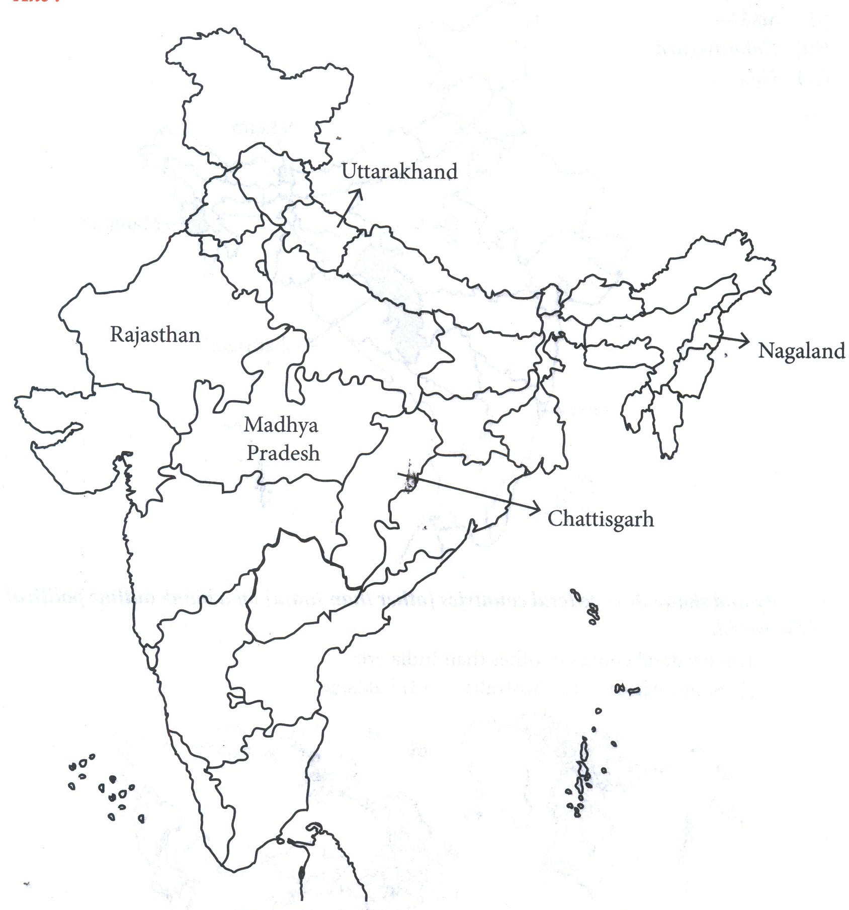
1.
Observe the map of India and
(a)Identify three state names in 1947 that have changed later
(b)Identify any three states which have been carved out of a bigger state.
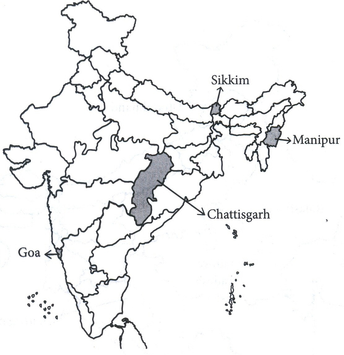
2.
Locate the following states on a blank outline political map of India
(i)Manipur
(ii)sikkim
(iii)Chhattisgarh
(iv)Goa
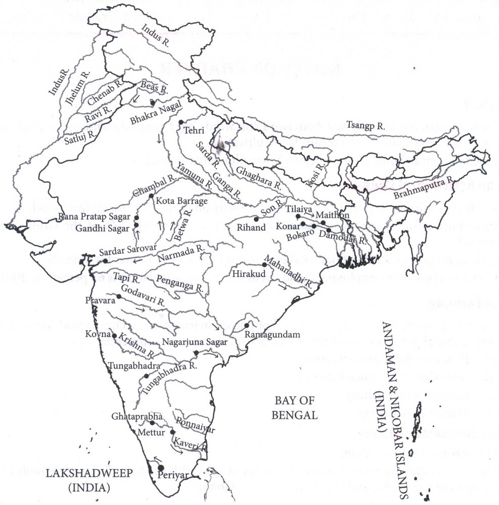
3.
In the outline map of the India, show the following multi-purpose projects or dams.
(a) Bhakra
(b) Damodar Valley
(c) Nagarjuna Sagar
(d) Hirakud
(e) Chambal
4.
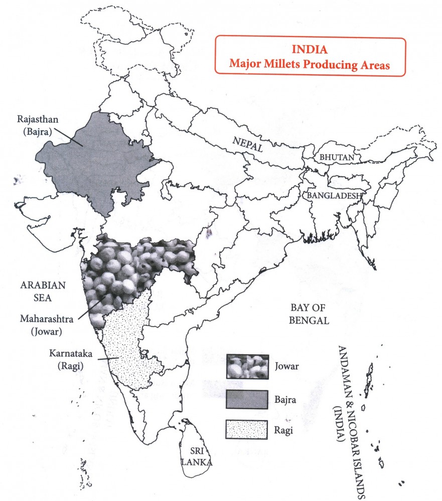
On the given political map of India, identify major
(a) Ragi producing states
(b) Bajra Producing states
(c) Jowar producing states.
5.
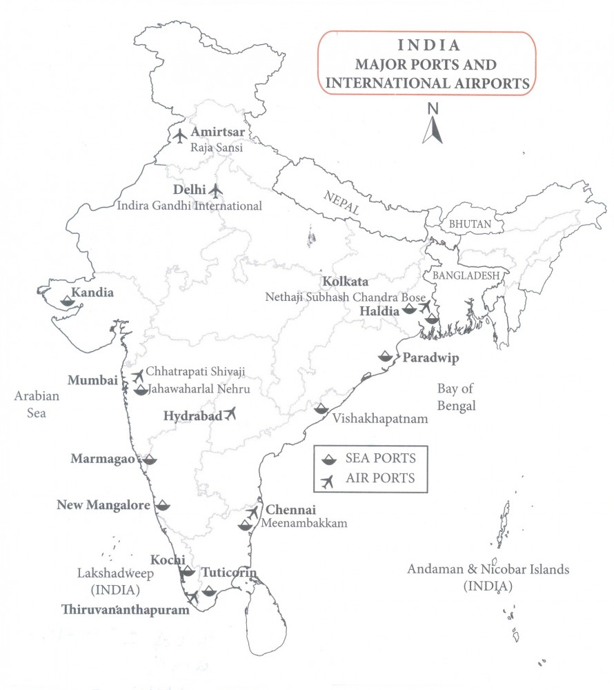
Locate and label the following on the political outline map of India:
(a) Kandla - sea port
(b) A major sea port in Gujarat
(c) Vishakhapatnam - sea port
(d) Kochi - sea port
(e) A major sea port in Kerala
(f) Chhatrapati Shivaji international airport
(g) Tuticorin.
6.
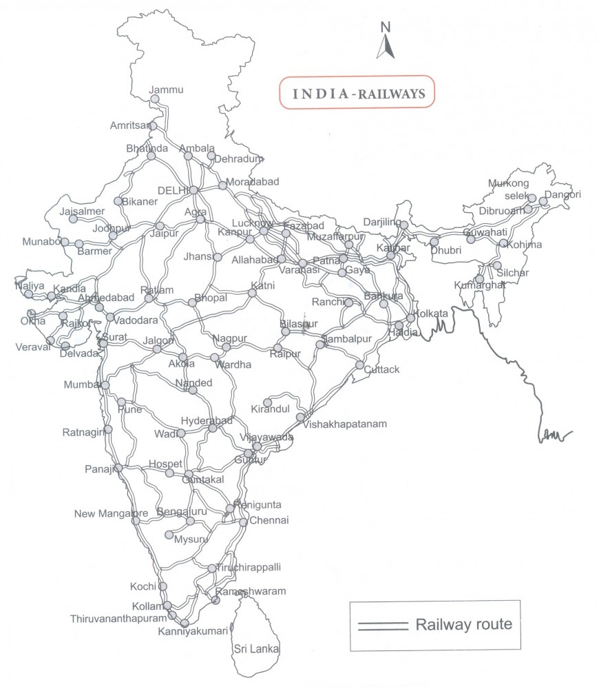
Study the railways network in India.
7.
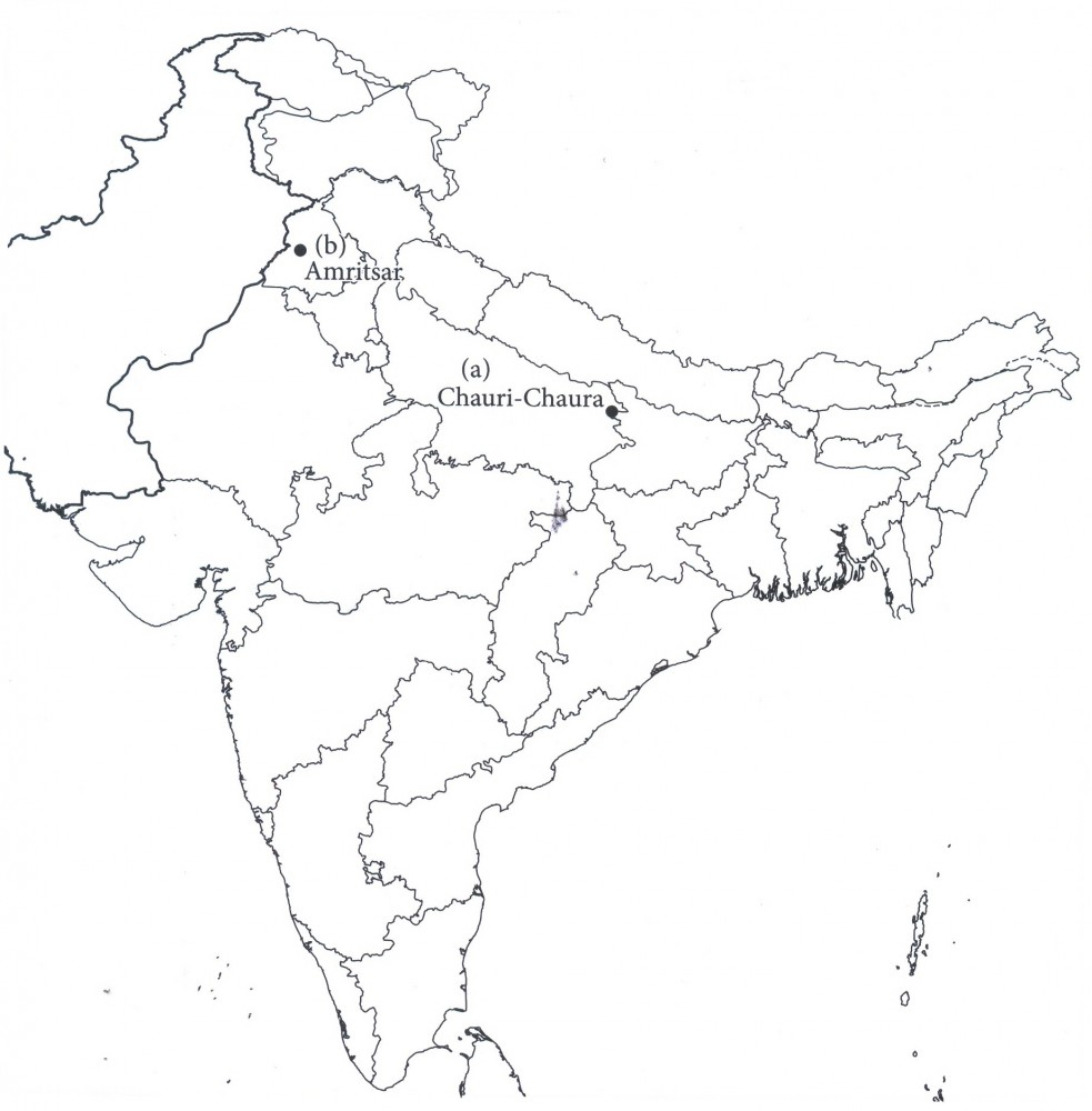
Locate and label the following items with appropriate symbols on the same map:
(a) Chauri-Chaura-The place of calling off the Non-Cooperation Movement (N.C.M.)
(b) Amritsar-The place where Jallianwalla Bagh incident took place.
8.
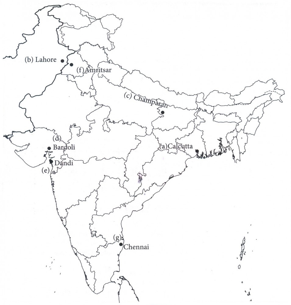
Locate and label the following on the given political outline map of India:
(a) A place where session of Indian National Congress was held in September 1920.
(b) A place where session of Indian National Congress was held in 1929.
(c) A place in Bihar where Satyagraha Movement of indigo planters took place.
(d) Baradoli, the place, from where No tax campaign was started.
(e) A place in Gujarat where Gandhiji violated the Salt law.
(f) a place in Punjab where Jalianwalla Bagh incident took place (or) Amritsar
(g) Chennai (Madras)
9.
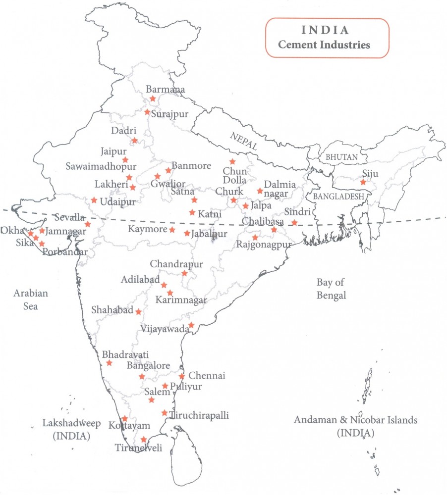
Study the given outline map of India showing the Cement Industries in India.
10.
Study and Observe the following map of conventional source of energy. Write the names of coal mines and oil fields with respective states.
1.
2.
3.
4.
5.
6.
7.
8.
9.
10.
Coal fields
(a) Bokaro, Jharia: Jharkhand
(b) Talcher: Odisha
(c) Neyveli: Tamil Nadu
Oil fields
(a) Ankaleshwar: Gujarat
(b) Digboi: Assam
(c) Mumbai high, Bassein: Maharashtra

10th Standard CBSE Syllabus & Materials
10th Standard CBSE
CBSE 10th Social Science PS - Federalism - New Model Questions Papers Study Material - QB365 Set A
NEW10th Standard CBSE
CBSE 10th Social Science PS - Power Sharing - New Model Questions Papers Study Material - QB365 Set A
NEW10th Standard CBSE
CBSE 10th Social Science GEO - Manufacturing Industries - New Model Questions Papers Study Material - QB365 Set A
NEW10th Standard CBSE
CBSE 10th Social Science GEO - Minerals and Energy Resources - New Model Questions Papers Study Material - QB365 Set A



CBSE 10th Standard CBSE Subjects
CBSE Standards